README
![]()
![]()
![]()
![]()


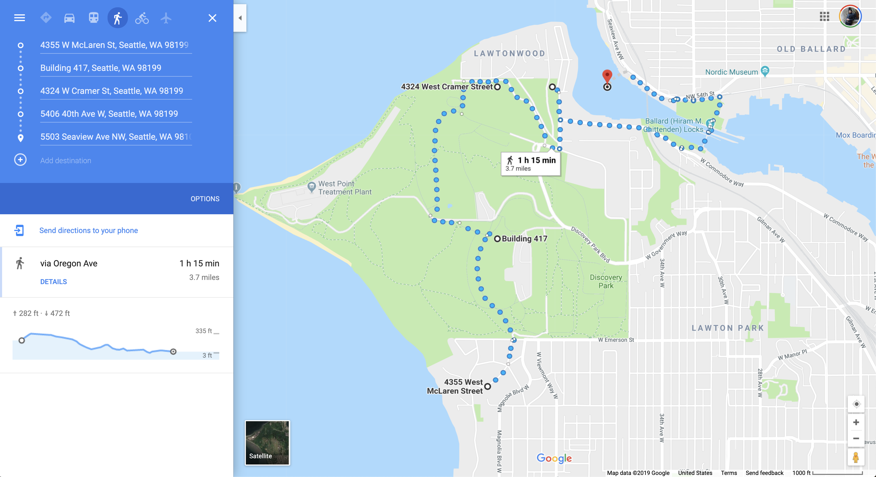
This is a computational library which finds the most nature-filled walks/paths that can be taken in order to stimulate creativity and boost mental health. Pathfinding is performed via Weighted Graph computation, with weights being given for characteristics such as proximity to parks, and amount of nature in the field of view.
Originally started at the TT West AEC Hackathon in Seattle, 2019.
Proof of Concept
Currently, the library computes paths within the boundaries of the user-defined grid (created from the user's origin and desired radius). Future development will target more route-finding options such as loops, distance constraints, sun/shade preferences, etc.
Usage
To use this module, install locally using the command below, or clone this repository and import the .js files directly from source.
npm i @nbbj/stroll
Environment Variables & API Provisioning
Before using this module, the GMAPS_KEY environment variable must be set on your machine with your specific Google Maps API Key. Additionally, you must provision your Google account for access to these specific Google Maps APIs: Directions API, Geocoding API, Maps JavaScript API, Places API, and Street View Static API.
This package will not working without the following configurations and provisions, so please make sure to check those settings if you are getting errors.
User API Usage Notice
Please be advised that this module will request Google Street View images from the Google Maps API, and therefore WILL incur a cost. Managing the cost and/or other API-specific limits/resource constraints are entirely the responsibility of the user using this module.
Imports
Imports can be done through the aggregating index.js file or via individual members.
Full Import
const stroll = require('./index.js'); // from source
const stroll = require('@nbbj/stroll') // from npm

// es6
import * as Stroll from "../src"; // from source
import * as Stroll from from "@nbbj/stroll"; // from npm
Individual Import
// from source
const Color = require('./Color');
const Place = require('./Place');
const Weather = require('./Weather');

const { Route } = require('@nbbj/stroll');
const { Color } = require('@nbbj/stroll');
import { Weather, Place, Color, Route } from "@nbbj/stroll"; // es6
Methods
The collection below is just a sample of methods and may be out of date. For the most recent examples, please see the samples folder in the root directory of this repository.
Pathfinding Data
Building graphs and calculating paths of travel.
// Create a custom grid around a origin lat/long
let grid = Geometry.PointGrid(47.660273, -122.409887, 1, 0.5);

Graph.GetData(grid) // get data for each lat/long point on the grid
  .then(grid => Graph.Create(grid, 0.9)) // create the weighted graph from the grid data
  .then(graph => Route.PathsAll(graph)) // find all possible paths
  .then(paths => Route.ParsePaths(paths)) // return sorted paths
  .then(results => {
    console.log(results); // do something with results (array of all possible paths)
  }).catch(err => console.error(err));
Place Data
Place data for nearby public parks/green amenities. Used for finding public parks and other notable green spaces near any point on earth (lat/long).
Place.ParkSearch(47.660273, -122.409887, 1000).then(results => {
  console.log(results);
});
Weather Data
Weather data analysis. Currently not used in the nature score calculation, but itended to be added.
let sunData = Weather.SunPositionToday(47.6694956, -122.31547389999999);
console.log(sunData);
Color Palette Analysis
Color palette analysis in field of view. Used for calculating how much of the visible color palette at any point on earth (lat/long) is green (nature).
Color.Palette(46.414382, 10.013988, 151.78).then(colors => {
  console.log(colors);
});
Color.PaletteNames(46.414382, 10.013988).then(names => {
  console.log(names);
})
Color.PaletteAnalysis(47.660259, -122.408417).then(result => {
  console.log(result);
})
Working Model
The working model to compute the "Nature Score" of a given point in the urban environment is composed of the following:
- Green Score - What percentage of an image's dominant color palette is green in color.
- Park Score - How many public parks/green spaces are near the given point, as computed by Google Maps.
Next steps for development are to add the following criteria to the "Nature Score" computation:
- Trees - Use a ML model with transfer learning to recognize natural feature such as trees, lakes, etc. which may not be captured by the "Green Score" in the color palette.
- Sun/Shade - Compute "sunny-ness"/"shady-ness" of a given route.
- Rain/Cover - Compute a route based on cover during a rain event.
Development
Building
The module can be built by running npm run build in the root directory of this repository. Documentation is built using the Documentation module from npm, and by running npm run docs in the root directory of this repository. This will create markdown and HTML documentaion.
Testing
Testing is handled using jest and code coverage is evaluated using nyc. Tests can be initiated by running npm test in the root directory of this repository.
Commands
The following commands are available during development.
npm test # run tests with Jest
npm run coverage # run tests with coverage and open it on browser
npm run lint # lint code
npm run docs # generate docs
npm run build # transpile code