README
aframe-atoll-terrain
An A-Frame WebVR primitive that has a circle of high-resolution terrain near the origin, surrounded by a low-resolution sea or plain that stretches to the horizon. Optionally, the high-resolution area can include a central plateau or sea.
Uses a grid of equilateral triangles for efficiency. Usable on mobile, with moderate detail.
Pairs well with aframe-simple-sun-sky or aframe-sun-sky
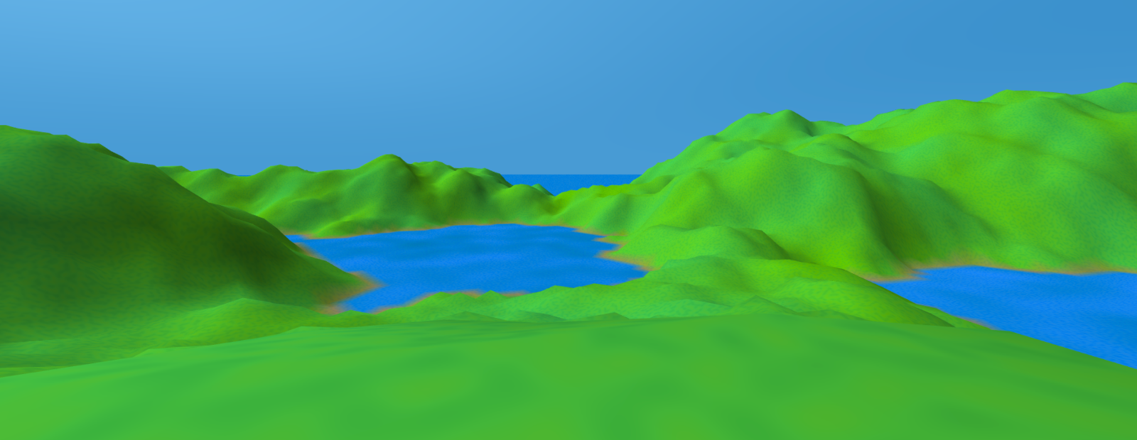
live example scene Use VR controller joystick or touchpad to move around. On desktop, drag to turn and use WASD keys to move. Reload several times to see some variations, especially if you don't see water.
Usage
Include using
<script src="https://unpkg.com/aframe-atoll-terrain@^0.7.0/dist/aframe-atoll-terrain.js"></script>
Declare it as a direct child of the scene (normally):
<a-scene>
    <a-atoll-terrain plateau-radius="5" middle-radius="400" unit-size="4" far="4000"
                     land-yin-color="#528d04" land-yang-color="#278d53" sea-yin-color="#005e85" sea-yang-color="#2571cf"
                     sun-position="0.8 0.6 0">
    </a-atoll-terrain>
    <!-- ... -->
</a-scene>
Parameters
Typically, you'll leave the entity position and rotation as zero, but you don't have to.
mean-elevation
- default: 10
The average elevation of the high-resolution area, in meters (before the sea floods everything below 0).
plateau-radius
- default: 10
- minimum: 0
- maximum: middle-radius - 2*unit-size
Radius of the central plateau, in meters. If radius is 0, there is no plateau.
plateau-elevation-min
- default: 1
Minimum elevation of the plateau. Can be 0, in which case the "plateau" might be sea or land.
plateau-yin-color, plateau-yang-color
- default: land-yin-color, land-yang-color
Values close to land-yin-color and land-yang-color typically work best.
middle-radius
- default: 100
Radius of the high-resolution area, in meters.
unit-size
- default: 1
Distance between vertexes in the high-resolution area, in meters.
Will be adjusted to be a simple fraction of middle-radius, if necessary.
far
- default: 4000
- minimum: middle-radius + unit-size
Radius of the low-resolution plain, in meters. Thus, it's also the distance to the effective horizon. Should be about 80% of the radius of your sky sphere.
land-yin-color, land-yang-color
- defaults: #528d04, #278d53
The color of the land smoothly varies between these two extremes. Typically, you'll want them to vary mostly by hue and saturation, rather than intensity. Noise will cause brief excursions outside this range.
sea-yin-color, sea-yang-color
- defaults: #528d04, #278d53
The color of the sea smoothly varies between these two extremes.
sun-position
- default: {x:-1.0, y:1.0, z:-1.0}
The direction from which the sun is shining. This primitive ignores directional lights, but others may use them. If you're using one of the *-sun-sky primitives, set its sun-position to the same value.
shader
- default: 'vertex-color+noise'
If you use a different shader, the colors and sun-position will probably be ignored.
log
- default: false
Whether to write diagnostic data to the console.
Development
npm install
edit files
npm run-script build
Internals
The geometry component sets vertex colors, so you should probably use a material that uses them.